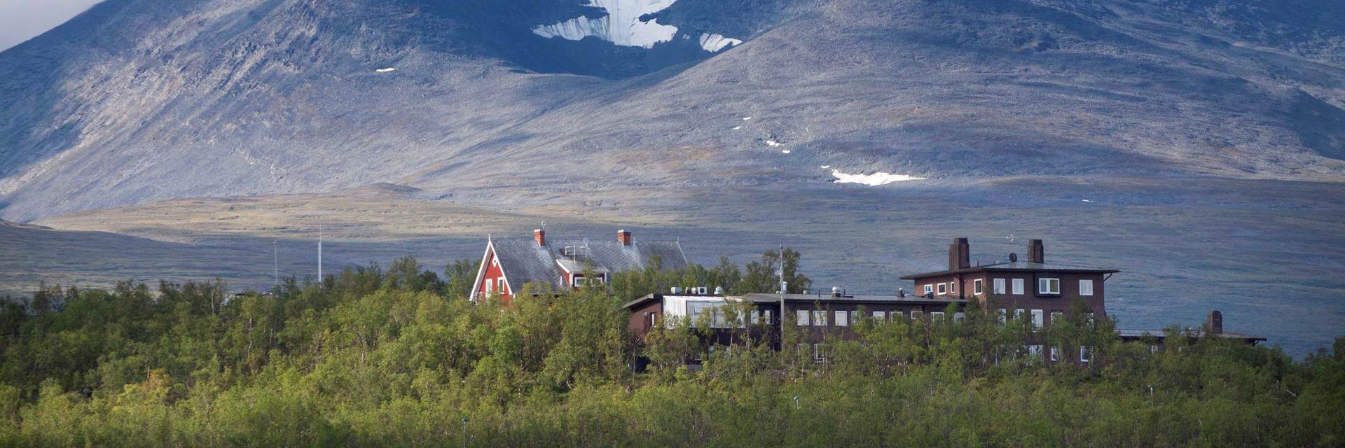
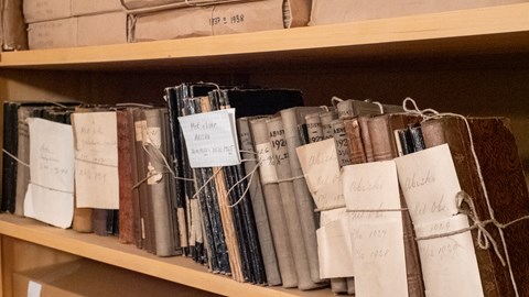
Data from Abisko Scientific Research Station
At Abisko Scientific Research Station, environmental measurements have been conducted since 1913. Data are also continuously collected in the surrounding environment, including at our field huts. Below, you can access our open data via links to databases or via the specified contact address.
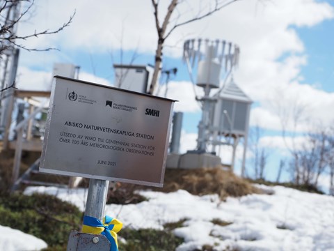
At the Abisko Scientific Research Station, several meteorological measurement series are longer than a hundred years. The World Meteorological Organization (WMO) has designated our observatory as a Centennial Observing Station. It is now part of a worldwide network of meteorological measuring stations with long qualitative measurement data.
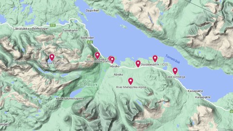
Interactive map of monitoring sites.
Abisko automatic station (SMHI no: 188790)
Meteorological data from Abisko's automatic measuring station for the years 1985-1996 and 2018 - ongoing. Data is stored in SMHI's system and available through their open data portal. Parameters: air temperature, precipitation, humidity, wind speed, wind direction and air pressure.
Data from the period 1996-2018 as well as more parameters (sun time, solar radiation, PAR, and soil temperatures) are available via ANS-data@polar.se.
Abisko manual station (SMHI no: 188800)
The manual observations started in 1913. Air temperature, precipitation and snow depth are digitized and available via SMHI's open data portal. The work with digitization continues and more parameters will be published continuously. For questions and access to data, contact ANS-data@polar.se.
Other data from Abisko Scientific Research Station
The work with digitization continues and more parameters will be published continuously. For questions and access to data, contact ANS-data@polar.se.
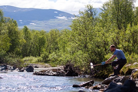
Miellejohka – Abisko
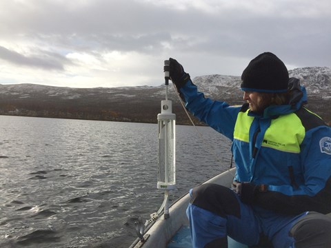
Miellejohka is a mountain stream that runs from Lapporten (Lake Čuonzájávri, 950 m above sea level) to Lake Torneträsk (341 m above sea level). Miellejohka is a part of the SITES environmental monitoring programme.
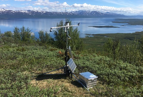
Nuolja – Abisko
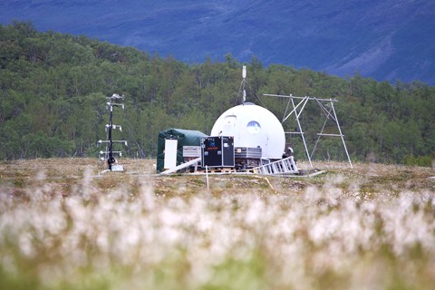
Nuolja is a mountain west of Abisko, peak elevation 1169 m above sea level. The meteorological station is located at the tree line.
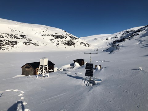
Latnjajaure – Abisko
Latnjajaure is an alpine site, located west of Abisko, 992 m above sea level. The place can be reached by helicopter all year round, in summer on foot and in winter by snowmobile via Låktatjåkka.
Almbergasjön – Abisko
Almbergasjön is a lake located approximately 14 km east of Abisko, 380 m above sea level. Almbergasjön is a part of the SITES environmental monitoring programme. Here, we monitor chemical and physical parameters in the lake as well as complementary meteorological data.
Contact ans-data@polar.se to get access to data from Almbergasjön.
Stordalen – Abisko
Stordalen is a mire located 10 km east of Abisko. The mire consists of sporadic permafrost palsas, bog areas, fens and lakes. Stordalen is classified as a nature reserve and is frequently used for research activities. Stordalen is a part of ICOS and SITES environmental monitoring programmes.
About SITES
SITES (Swedish Infrastructure for Ecosystem Science) is a national infrastructure for terrestrial and limnological field research. SITES aims to promote high-quality research through long-term field measurements and field experiments and by making data available.
The core of SITES is nine field research stations that represent a variety of Swedish climate zones and ecosystems, including agricultural land, forests, wetlands, lakes and streams. SITES aims to offer researchers, regardless of institution, well-functioning infrastructures for field research. SITES also runs several long-term data collection programmes that provide researchers with contextual data.
About ICOS
The Integrated Carbon Observation System, ICOS provides standardised and open data from more than 140 measurement stations across 13 European countries. The stations observe greenhouse gas concentrations in the atmosphere as well as carbon fluxes between the atmosphere, the land surface and the oceans. Thus, ICOS is rooted in three domains: Atmosphere, Ecosystem and Ocean.
The Swedish Polar Research Secretariat's representatives in ICOS
Erik Lundin, ICOS station PI, Abisko-Stordalen
Niklas Rakos, ICOS engineer, Abisko-Stordalen
How to cite data from ICOS Sweden
Data from ICOS Sweden stations are open under the Creative Commons Attribution 4.0 International License following the FAIR principles. We thus require a proper reference and citation of the ICOS data, using the exact citation (including the provided doi or pid) as provided by ICOS. If the main content of a scientific paper is based on data from ICOS Sweden stations, please, acknowledge the Swedish Research Council (SRC) who co-finances ICOS Sweden under the grant number 2019-00205 .
If using data from Abisko-Stordalen, please, acknowledge additionally the Abisko Scientific Research station (ANS).
We kindly ask you to inform the data providers, traceable through the metadata connected to the provided DOI or PID, when the data are used for publication(s), and to offer them the possibility to comment and/or offer them co-authorship or acknowledgement in the publication when this is justified by the added value of the data for your results.
