Canada-Sweden Arctic Ocean 2025
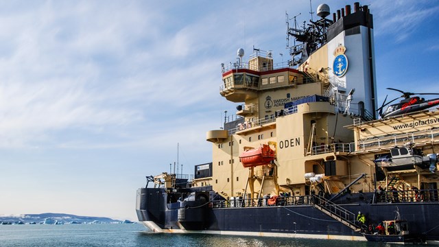
From August 9 - September 19, 2025, the icebreaker Oden carried out an expedition with the Canadian icebreaker CCGS Louis S. St-Laurent to map the seabed in the Arctic Ocean, which is taking place within the framework of the UNCLOS program (United Nations Convention on the Law of the Sea). In symbiosis with this, an extensive Early Career Scientist program also takes place on board Oden, consisting of the course The Arctic Ocean Climate System.
The UNCLOS program will contribute data to the Ocean Decade Alliance's seafloor mapping initiative, the General Bathymetric Chart of the Oceans (GEBCO) and the International Bathymetric Chart of the Arctic Ocean (IBCAO).
The Early Career Scientist program combines practical work with observations and measurements in seven work packages (WPs) that are linked to the participants' own research projects.
WPs will be organized to carry out research work, observations and sampling, as on a regular research expedition on the Oden. The students will participate in the practical work of their WP, under the instruction of their WP leaders. The difference to an ordinary research expedition is that work and navigation will be governed by limits set by the Canadian research team.
The Swedish Polar Research Secretariat is carrying out the expedition together with The Geological Survey of Canada, Land and Mineral Sector. In addition to Swedish and Canadian researchers, geologists from Denmark and Greenland will also participate. On the Canadian vessel, Inuit observers with specialized knowledge of marine mammals will be part of the team.
Alongside the geological surveys, Oden will also contribute to another forward-looking initiative: Polar Connect. The project involves planning the installation of new fiber-optic cables between Europe and Asia via the Arctic—an effort that could lead to faster and more secure internet connections in the future. A dedicated mooring system for scientific instruments will also be deployed in collaboration with the Norwegian research program Go North.

Work packages
Here’s a glimpse into the expedition’s twelve work packages (WPs), which together build new knowledge about climate, oceans, ice and life in one of the planet’s most vulnerable regions.
The ocean’s memory – geology and seismic imaging
Marine geology (WP 1)
Researchers extract long sediment cores from the seafloor using a range of coring systems. These layered sediments—sometimes millions of years old—reveal Earth’s climate history. Analyses include microfossils, ancient DNA, organic biomarkers, and paleomagnetism to reconstruct how Arctic sea ice has changed over time.
Seismics (WP 2)
Seismic reflection techniques are used to investigate bedrock beneath the ocean floor. Airgun arrays and long streamers are deployed to send sound waves into the subsurface. Echoes reveal the structure of Earth’s crust. The method is technically demanding, especially in ice-covered waters, and often supported by helicopters and sonobuoys. Data will also support Canada's Arctic UNCLOS claims.
Mapping from seafloor to surface
Geophysical mapping (WP 3)
Throughout the expedition, the seafloor will be mapped in three dimensions using multibeam echo sounders and sub-bottom profilers to capture both surface topography and underlying sediment structures. The processed data supports navigation, sediment coring, and scientific planning, and will be submitted to international seabed mapping repositories.
Sea ice properties (WP 4)
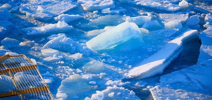
This work package studies how sea ice drifts, melts, deforms, and refreezes. GPS buoys are deployed in triangles on ice floes to track motion. Snow thickness, ice temperature, salinity, and structure are measured using drills, thermometers, drones, and photogrammetry. The data helps calibrate satellite imagery and improve models of ice dynamics.
Traces in water and air
Water isotopes (WP 5)
Water samples are collected from different depths to analyze stable isotopes of oxygen (¹⁸O), hydrogen (²H), and carbon (¹³C and ¹⁴C). These markers reveal the origin and transformation of water masses. Other samples are used to study the exchange of greenhouse gases like CO₂ and CH₄ between ocean and atmosphere.
Primary production and biogeochemistry (WP 6)
Phytoplankton, the microscopic plants of the ocean, are studied for their role in the carbon cycle and as the base of the marine food web. Researchers collect water and ice samples to analyze nutrients, chlorophyll, DNA, and RNA. Primary production rates are measured with isotope tracers, helping to understand Arctic ecosystem responses to climate change.
Oceanography and marine chemistry (WP 7)
This team investigates water circulation and mixing beneath the ice. Using CTD instruments and turbulence profilers, they assess temperature, salinity, density, and diffusion. The goal is to understand how storms, ice conditions, and meltwater affect nutrient transport and ocean structure.
Above the ice – weather and atmosphere
Meteorology (WP 8)
Weather and atmospheric conditions are monitored continuously using sensors, balloon-borne radiosondes, radar, and lidar. Measurements include wind, temperature, humidity, clouds, and turbulence. Students are involved in setting up new weather sensors. The data feeds into global weather forecasting and long-term climate research.
Art, outreach and education
Artistic work (WP 9)
Artist Sara-Vide Ericson participates in the expedition to collect material for large-scale paintings. Inspired by the ice, the landscape, and human presence, her work explores Arctic identity through staged imagery and emotional interpretation, adding a creative dimension to the science.
Teacher’s work (WP 10)
Teacher Cristina Bernardez Marti contributes to research while engaging young students. She collects plankton, sea ice and microplastic samples, and leads the Float Your Boat project—where decorated wooden boats from schoolchildren are released on drifting sea ice and tracked by satellite.
Technology below – and mercury on the move
NORCE, mooring observatory (WP 11)
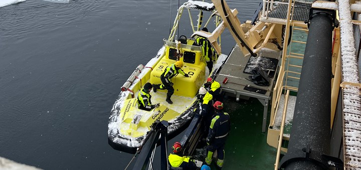
A long-term ocean observation system is deployed at the deep-sea hydrothermal site “Ultima Thule.” The mooring, consisting of sensors, floats, and a lander, records ocean conditions over time. Deployment requires good weather and precise coordination using support boats or platforms.
Mercury tracking (WP 12)
This work package investigates how the toxic element mercury moves through the Arctic environment. Using custom-built sea spray chambers and water sampling at various depths, scientists analyze mercury concentrations and isotopic fingerprints in seawater, sea spray, plankton, and ice. The goal is to better understand mercury cycling and its potential impact on Arctic food webs.
Where is Oden?
Expedition facts
9 August - 19 September 2025
Area: Central Arctic Ocean, Alpha Ridge and Mendeleev Rise
Ship: icebreaker Oden
ECS-program Coordinator: Michael Tjernström
Work Packages: 12
Nations on Oden: 8
Artist: Sara-Vide Ericson
Participant in the teacher program: Cristina Bernárdez Marti
Expedition Coordinator: Katarina Gårdfeldt

During Canada-Sweden Arctic Ocean 2025 with the icebreaker Oden, 38 researchers from eight countries will participate.
Oden – one of the world's leading platforms for marine polar research
The Swedish Polar Research Secretariat leases the icebreaker Oden from the Swedish Maritime Administration for the use of the icebreaker Oden during the summer half-year. With the help of the Swedish Research Council, other financiers, and researchers at Swedish universities, we have continually developed the icebreaker Oden into one of the foremost platforms in the world for research in the polar regions.

Professor Emeritus Michael Tjernström leads the Early Career Scientist program during the Canada-Sweden Arctic Ocean 2025 expedition.

Artist Sara-Vide Ericson has been accepted for this year's expedition to the Arctic aboard the icebreaker Oden – a unique opportunity to combine artistic creation with the extreme environment of the Arctic.


