Charting uncharted waters: report from the U.S. team
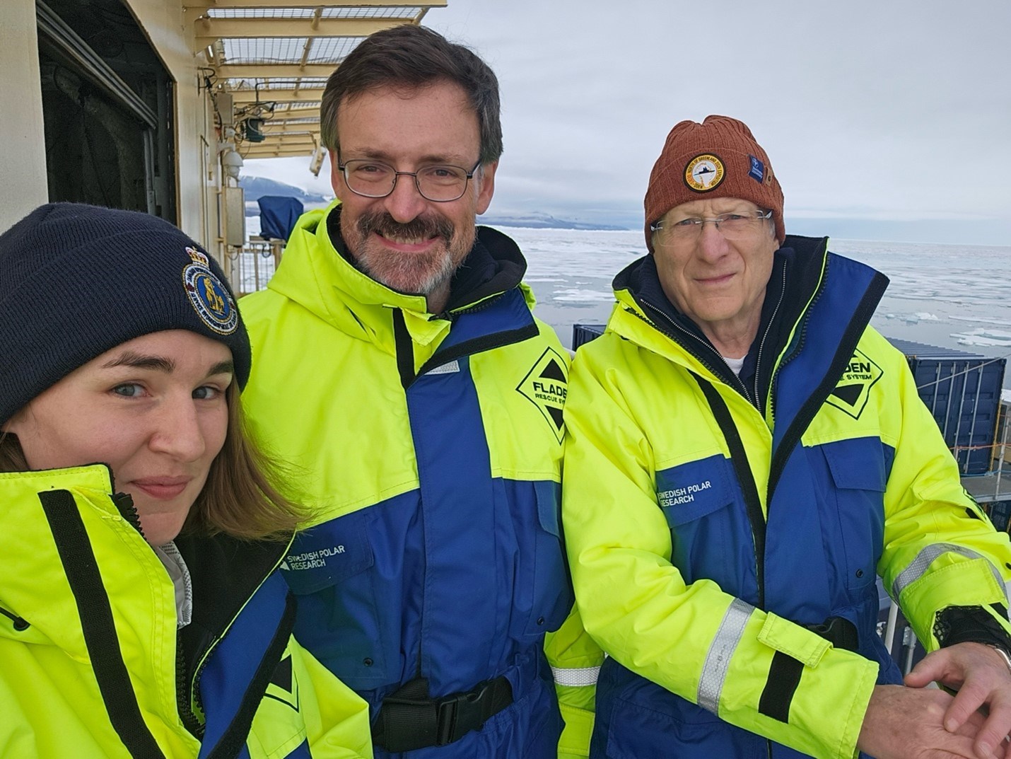
 The U.S. Team on the GEOEO North of Greenland 2024 expedition: Larry Mayer(right), Brian Calder (center), and Liz Weidner (left).
There are three of us from the U.S. on GEOEO24 (Brian Calder, Larry Mayer and Liz Weidner, Figure 1) though one of us (Brian) is Scots. Our group is from the Center for Coastal and Ocean Mapping (CCOM) at the University of New Hampshire (UNH) which is the U.S. center of excellence for research in ocean mapping. Larry is Director of the Center, Brian, Associate Director and Liz recently finished her Ph.D. at UNH, spent the last year as a Postdoctoral Fellow at Scripps Institution of Oceanography, and will soon be starting a new faculty position at the University of Connecticut. Our participation in GEOEO24 is the natural extension of a remarkable history of collaboration that began almost forty years ago between Professor Jan Backman from Stockholm University and Larry working together on many deep-sea drilling projects, mostly in the equatorial Pacific. This eventually led to collaboration in the Arctic on the ACEX Arctic drilling proposal, Martin Jakobsson spending several years as a visiting researcher at CCOM and then our participation in the SWERUS, Petermann, and Ryder Expeditions.
On GEOEO24, the small U.S. team is on board to contribute to the overall geophysical mapping program. We are standing eight-hour watches monitoring the ODEN’s acoustic systems including the multibeam echosounder, subbottom profiler, EK80-scientific echo sounders and the ADCP (Acoustic Doppler Current Profiler). These systems offer the “geospatial context” for all else that we do on the ship. The multibeam echosounder provides a three-dimensional picture of the depth and shape of the seafloor that lets us know how and where warm ocean currents can enter the fjords and interact with the glacier (and thus affect the overall melting of the icesheet) as well as provide a picture of how the glaciers advanced and retreated over time. It also is essential for determining whether the ODEN can safely navigate in the uncharted waters in the area. The subbottom profiler provides the fourth dimension, letting us look back in time at the history of sediments deposited on the seafloor and identify locations for sediment cores that, when analyzed, provide the timing of glacial events. The scientific echo-sounders give us high-resolution pictures of biological activity and oceanographic boundaries in the water column. The Acoustic Doppler Current Profiler offers insight into the deep currents below the vessel. All of the other teams on board need these data to understand the spatial context of their biological, oceanographic or geochemical data.

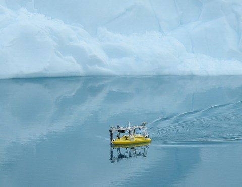
The U.S. team also came with our own science goals – our hope to use a small uncrewed surface vessel (USV) to get very close to and map the “glacial front” to better understand its morphology and ablation (mass loss) processes. The USV we brought was a Seafloor Systems Echoboat, a 1.7 m long, remote-controlled vessel equipped with a Norbit iWBMS multibeam echosounder with integrated inertial navigation and motion sensors, several cameras, and a Conductivity-Temperature-Depth (CTD) sensor for measuring water properties. The multibeam echosounder can be exchanged with a 200 kHz EK80 scientific echosounder for detailed mapping of the water column (Figure 2).
As the Oden made its way into Victoria Fjord, it became clear that ice would prevent us from gaining access to the “glacial front”. Moreover, the helo reconnaissance showed that in Victoria Fjord there was no simple glacial front, but rather a very complex region of breakup of the glacier at the grounding line. Such surprises are not uncommon when exploring unmapped regions and lead to the need for flexibility and innovation. We first attempted to use Echoboat as a helo-deployed echo-sounder carrying a borrowed (from Christian Stranne) deep-water scientific echosounder, but this failed because the wireless receiver on the Echoboat got a bit more wet than it was meant to, taking out the communication system. Fortunately, Christian and the team from KTH pieced together another system and were successful in making important depth measurements by helo deep into the fjord. Indicative of the spirit of collaboration on board, the KTH team generously leant us one of their wireless links and we were able to resurrect the Echoboat (appropriately rechristened Lazurus) and turn our focus to understanding the melting processes of the large icebergs that sit in the fjord. Initially we used ODEN’s workboat MUNIN to deploy the Echoboat to an iceberg in relatively open water, but later we were able to deploy the Echoboat directly from ODEN, making launch and recovery much simpler.
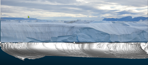
We have been able to survey four different icebergs and have been very pleased with the initial results. We have already produced 3-D images of the underwater morphology and structure of the icebergs noting consistent differences in underwater texture that appear to be related to above-water processes (Figure 3). We also believe that we can see meltwater plumes in the sonar imagery and are now working on creating 3D models of the parts of the iceberg that are above water. These are just very initial results; we have much work to do with these and all the other data sets collected on board. One thing is certain, however, and that is that the “risk” taken to bring ODEN to Victoria Fjord has more than paid off. Each of the teams on board will come home with unique data sets from a virtually unexplored region that will become important contributions to our broader understanding of changes in the Arctic and their global impacts.


